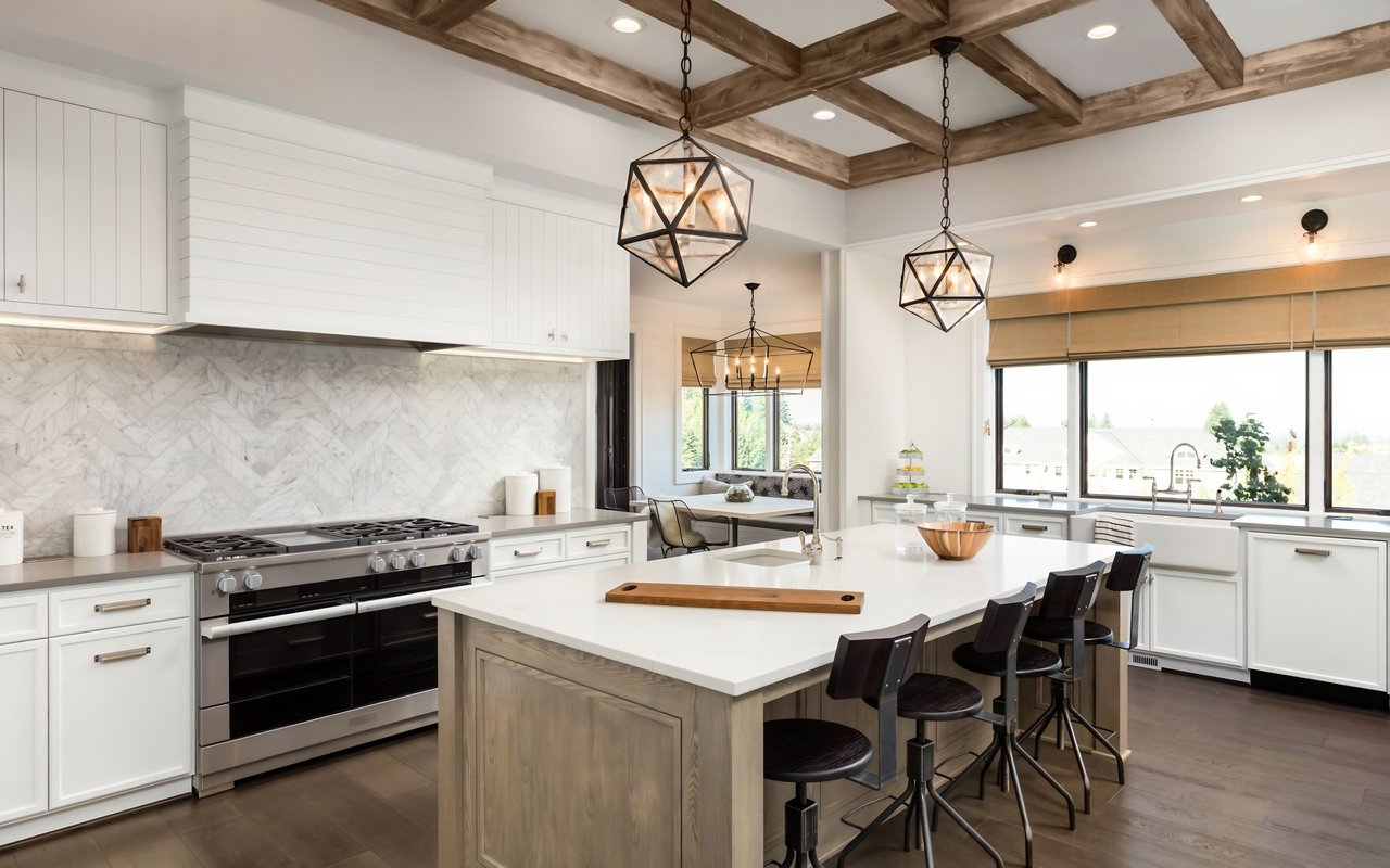
If you are thinking about life in Peachtree City, the golf cart paths are not just a fun extra. They are part of how many residents move through the day. From quick errands to park visits and community outings, the path system shapes a daily rhythm that feels connected and practical. Let’s dive in.
Why the cart paths matter
Peachtree City has built much of its identity around its shared-use path system. According to the city, Peachtree City covers about 26 square miles, had about 38,244 residents in the 2020 census, includes about 100 miles of paved shared-use paths, and has roughly 11,000 registered motorized carts.
That is a big reason the paths feel woven into everyday life instead of set apart from it. The city describes the network as a way to connect neighborhoods with shopping centers, places of worship, office and medical parks, schools, recreation centers, and lakes.
In other words, these paths are not only for weekend rides. They support a real transportation pattern that many people use for short trips around town.
What everyday travel looks like
One of the most distinctive things about Peachtree City is that a simple outing can feel different here. Instead of driving for every stop, you may be able to use the shared-use path system to get from your neighborhood to a retail area, a park, or a recreational facility.
The city notes that the paths run under and over major thoroughfares and connect destinations across the city’s five villages. That design helps create a smoother trip for local travel and gives residents another way to get around without relying only on a car.
For many people, that can change the pace of the day. A grocery run, library stop, or ride to a recreation center can feel more relaxed when it happens along wooded paths instead of only on main roads.
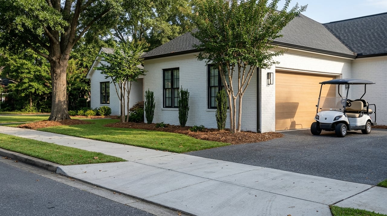
Golf carts are normal here
In Peachtree City, golf carts are a familiar part of local transportation. The city treats carts as part of its transportation ecosystem, which is one reason they are so visible in daily life.
That said, carts are also regulated. The city states that new cart owners must be at least 18 years old, register the cart within 10 days of purchase, and follow the city’s registration and transfer process.
The Police Department also operates a shared-use path and motorized cart safety program. That detail matters because it shows the path network is managed as a public system, not just a recreational feature.
Low-speed vehicles on the paths
Peachtree City also allows low-speed vehicles on the shared-use paths under specific rules. According to the city, these vehicles must be limited to 20 mph, properly registered and insured, tagged through the Fayette County Tag Office, driven by licensed drivers, and equipped with an amber strobe light.
The city also notes that non-resident owners pay a separate path user fee. If you are considering a move to Peachtree City, it is helpful to know that path access comes with local rules and procedures.
Running errands by cart
One of the biggest lifestyle advantages of the path system is how it connects daily destinations. City and tourism sources describe the network as giving secondary access to almost any destination within city limits.
That includes practical stops like shopping and dining. The visitor site notes that many businesses offer designated golf cart parking spaces, which makes quick trips easier once you arrive.
Retail and mixed-use areas named by the city include Aberdeen Village, Braelinn Village, Kedron Village, The Avenue, The Promenade, Westpark Walk, and Willowbend Center. These are the kinds of places that help show how the path system fits into ordinary routines.
A simpler way to make short trips
For some residents, the appeal is not just convenience. It is also the feel of the trip itself.
Short outings can become a more enjoyable part of the day when you are moving through trees, green space, and village connections. That slower pace is a recurring theme in how the city describes the path system and its role in linking homes with shopping, schools, parks, and village centers.
Recreation is built into daily life
The golf cart paths also make it easier to reach some of Peachtree City’s well-known recreation spots. The visitor site highlights destinations such as Drake Field, Village Green Park, Kedron Fieldhouse & Aquatic Center, Braelinn Recreation Complex, Glenloch Recreational Complex, Riley Field Recreation Complex, McIntosh Trail Recreation Complex, and Lake Kedron.
That means recreation does not always require a full car trip or a major plan. Depending on where you live, a workout, park stop, or lake outing may feel more like a natural extension of the day.
The same is true for local cultural spaces. The city highlights the Frederick Brown, Jr. Amphitheater, known as The Fred, along with the public library, Line Creek Nature Area, and Flat Creek Nature Area.
Nature access by path
Flat Creek is especially tied to the cart-path experience. The city notes that its boardwalk and trail access can be reached from the nature trail beside The Fred Amphitheater or from the cart path itself.
That kind of access adds another layer to daily living in Peachtree City. You are not just getting from place to place. You are also moving through some of the natural spaces that help define the city’s character.
How the village model shapes the experience
Peachtree City was planned around a village-based model, and that planning still influences how people live and move today. City planning materials describe village centers as places that include retail, office, and service uses, with recreation and other residential areas positioned in relation to those centers.
Because of that layout, not every neighborhood feels the same. Some homes are closer to village centers and everyday retail, while others sit in quieter low-density residential areas that are still connected by the same path network.
For buyers, this is an important point. Living near the path system does not mean one single lifestyle. It can mean easier access to retail and activity, or it can mean a more tucked-away residential setting with path connections still nearby.
What buyers should pay attention to
If you are exploring homes in Peachtree City, it helps to look beyond the house itself and think about how you want to use the path network. Consider questions like:
- How close do you want to be to a village center?
- Would you use the paths for errands, recreation, or both?
- Do you want easier access to shopping and activity, or a quieter setting with path connectivity?
- Which recreation spots, lakes, or gathering places matter most to your routine?
Those details can shape how the city feels once you actually live there.
Tools that help you navigate
The city promotes the NavigatePTC app as a tool for finding paths, sharing location, and locating dining and shopping. For people new to the area, that can help make the system easier to understand.
The city’s cycling information also highlights bike-friendly routes on Huddleston Road, Dividend Drive, and Robinson Road. Together, these resources reinforce that Peachtree City supports multiple ways of moving through town.
What makes this lifestyle stand out
Many communities have trails or parks. Peachtree City stands out because its shared-use paths are part of the structure of daily life.
They connect neighborhoods, retail nodes, recreation centers, schools, lakes, and civic spaces across the city. That creates a lifestyle where short local trips can feel more connected, more scenic, and often more convenient.
If you are relocating or comparing neighborhoods, this is one of the features that can truly change how a place feels once you live there. In Peachtree City, the golf cart paths are not just part of the backdrop. They are part of the routine.
If you want help understanding how different neighborhoods connect to Peachtree City’s path system and daily amenities, Vicki Morris would be glad to guide you with the personalized attention you deserve.
FAQs
How many golf cart paths are in Peachtree City?
- Peachtree City reports about 100 miles of paved shared-use paths across the city.
Are Peachtree City golf cart paths only for recreation?
- No. The city describes the path system as connecting neighborhoods with shopping centers, schools, recreation centers, office and medical parks, lakes, and other daily destinations.
Can you use a golf cart for errands in Peachtree City?
- Yes. City and tourism sources describe the paths as providing access to shopping, dining, parks, and other destinations, and many businesses have designated golf cart parking spaces.
Are golf carts regulated in Peachtree City?
- Yes. The city says new cart owners must be at least 18, register within 10 days of purchase, and follow the local registration and transfer process.
Can low-speed vehicles use the Peachtree City path system?
- Yes, if they meet the city’s rules, including a 20 mph limit, registration, insurance, Fayette County tagging, a licensed driver, and an amber strobe light.
How do Peachtree City villages affect golf cart living?
- The village-based layout means some neighborhoods are closer to retail and service centers, while others are in quieter residential areas that still connect to the same path network.